
Last updated on July 18th, 2026 at 08:30 pm
Looking for the best way to beat the heat in Northern Virginia this summer? Head to Shenandoah National Park, where scenic hiking trails lead to crystal-clear swimming holes, refreshing mountain streams, and natural pools perfect for cooling off after a hike. In this series, I’ll take you to the 10 best swimming hole hikes in Shenandoah National Park—from the secluded Seven Pools to Whiteoak Canyon, Rose River, Riprap, and more. If you love hiking, waterfalls, and hidden places to swim, you’re going to love this series. Follow along, and let’s hit the trail!
When the summer heat and humidity arrive, hiking can be a tricky endeavor. For me, there’s no better way to cool off than combining a scenic hike with a refreshing swim beneath a cascading waterfall. Shenandoah National Park is filled with trails that lead to crystal-clear pools, rushing streams, and hidden swimming holes tucked deep within the forest. These hikes offer the perfect balance of adventure and relaxation — rewarding sweaty climbs and sun-soaked afternoons with the chance to wade into icy mountain water surrounded by some of Virginia’s most beautiful scenery. Whether you’re chasing waterfalls, escaping the humidity, or simply looking for a memorable summer day outdoors, swimming hole hikes turn an ordinary trek into the ultimate warm-weather experience.
About Swimming in Shenandoah National Park
Swimming and wading in the waters in Shenandoah National Park is permitted. However, please note that these pools and falls typically require a hike along rocky terrain and, as such, should be taken seriously. Flip flops are never a good idea. Nor is climbing on the rocks around waterfalls. Even at swimming holes without waterfalls, be aware that jumping from rocks always carries risks that change with water depth and conditions. Remember that you are engaging in these activities at your own risk, and rescues can take hours. So please be careful and follow practical hiking safety precautions.
How to Use this Guide
In the following paragraphs, I’ll provide a summary of my favorites from the northern end of the park to the south, including distance/elevation gain (as recorded by the AllTrails app) and a description of the swimming spot. I also offer optional routes for reaching the swimming spot, so you can choose your hike duration.
The guide is not intended to provide specific step-by-step guidance on the actual hikes. Instead, use an app like AllTrails or GAIA, or paper maps like the PACT trail maps or the National Park Service maps I link to after each hike summary.
Each hike is listed geographically, and I note which district (Northern, Central, or Southern) in the heading. If you don’t understand Shenandoah National Park’s layout, please see the full explanation and video in my camping guide.
Seven Pools (Overall Run Trail) – Northern District
The combination of an approachable hike, dramatic scenery, and refreshing swimming holes has made Seven Pools one of the most beloved summer escapes near Shenandoah National Park. Often linked with a hike to the Overall Run Falls overlook, this easy-to-moderate hike leads to a series of cascading natural pools carved into the rocky streambed, creating one of the most inviting swimming destinations in the region.
If you hike from the park boundary in Bentonville, you’ll walk about a mile on the road (VA 630) to the Thompson Hollow Trail. Then .8 miles later, you’ll come to the intersection of the Overall Run Trail to the right and the Tuscarora Overall Run Trail to the Left.
- Shortest Option ~4 miles: To go directly to the pools, turn right and proceed for 1/10th mile, where you’ll see an unmarked path on your left. This is the access point.
- Longer Hike ~9.5 miles: If you’d like to see Overall Run Falls from the overlook (there is no trail to the base of the falls), you can turn left at the intersection up the Tuscarora Overall Run Trail for three miles. There are two overlooks within 2/10ths of a mile. At that point, you can turn around and head to the pools, but I’d recommend continuing on for the larger loop with the Beecher Ridge Trail. The intersection is just another ½ mile from the Upper Falls viewing area. Then it is an easy downhill, forested walk on the Beecher Ridge and Beecher Overall Run Connection Trails back to the Overall Run Trail, with the pools now on your right. Total: 9.6 miles, 2188’ elevation gain.
Note: Parking is an issue at the boundary. There used to be a designated parking area near the Thompson Hollow trail, but it has been removed, and numerous No Parking signs are posted. We parked by a house with a sign that said parking was allowed. It was an easy 1.8-mile walk from there to Overall Run Falls trail.
Option: You can take the loop from Skyline Drive inside Shenandoah National Park, but the swimming hole is at the lowest elevation midway through that hike. That means you’ll have to trudge back up for about 4.5 miles after cooling down.
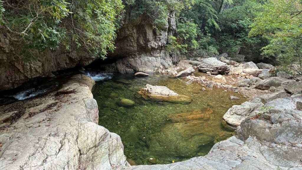
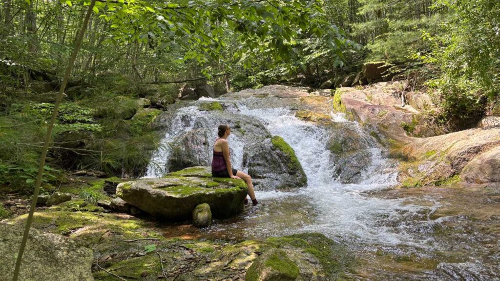
Hazel River Falls & Caves – Central District
At 5.5 miles and just over 1000’ of elevation gain, this trek is fairly easy except for the steep descent from the White Rocks Trail down to the Hazel River. It’s rocky both going up and coming down the .25-mile Cave Falls Spur Trail, so be sure to take your time.
Centrally located, just 2 miles from the Thornton Gap entrance, the hike begins at the Meadow Spring parking area near mile 33.5 on Skyline Drive. Unlike some of Shenandoah’s busier waterfall trails, Hazel Falls is smaller (really just a cascade from a rock in the river) and feels more secluded. On weekdays, you may get it all to yourself. At the end of the trail, the Hazel River (really more of a creek at this point) spills into a shallow swimming hole surrounded by massive boulders and small cave-like rock overhangs that give the hike its name. On a hot summer day, it’s an ideal place to relax in the shade, dip your feet, or submerge your body in the cold mountain water.
Option: For a longer loop hike, consider the Cave Falls via Hazel Mountain and White Rocks Loop: 9.1 miles, 2119’ elevation gain.
Nicholson Hollow – Central District
The Nicholson Hollow Trail is absolutely beautiful, following the Hughes River and offering numerous cascading pools to dip your toes in and larger pools to soak your entire body. The other nice thing about this trail is that you can create so many different options by changing your starting point (from the boundary or Skyline Drive) and linking it to other adjacent trails.
My personal favorite is a 6.5-mile trek (round-trip) with just 880’ elevation gain. You park at the far end of the Old Rag parking lot and have a short 0.1-mile road walk to access the trailhead. Soon after entering the woods, you’ll encounter a water crossing with big boulders to walk across. From that point, you’ll experience a gradual incline as you make your way up the river. The first swimming hole is only 1.5 miles from the parking lot. I’ve had 50/50 luck having this to myself on weekdays. I typically go straight to the other swimming hole and the turnaround point of this hike, 3.25 miles from the parking lot. Since most people stop at the first one, this natural pool is typically a quiet respite from crowds. If you haven’t ever visited the historic Corbin Cabin, add that on by continuing up the Nicholson Hollow trail for an additional 1.2 miles.
Options: If you’re hiking the Hughes River area, it’s worth taking the short detour to Corbin Cabin for a glimpse into Shenandoah’s human history. Built in 1909 by George Corbin and his family, the simple mountain cabin offers a tangible connection to the people who lived in these hollows long before the area became a national park. Standing on the cabin’s porch and imagining the challenges of daily life in this remote valley adds an entirely different dimension to the hike. The stop transforms a scenic walk into a journey through both the natural and cultural history of the Blue Ridge Mountains.
- Nicholson Hollow Out & Back (from Old Rag Parking) 8.6 miles, 1217’ elevation gain
- Corbin Mtn & Nicholson Hollow Loop (from Old Rag Parking) 12.6 miles, 2375’ elevation gain July 23, 2025
- Nicholson Hollow & Corbin Cabin Loop (from Skyline Drive) 7 miles, 1827’ elevation gain. The standard 5-mile loop from Skyline Drive can be extended by 2 miles (round-trip) from the cabin to the swimming hole mentioned in the recommended hike above.
Whiteoak Canyon & Cedar Run Loop – Central District
Shenandoah National Park’s most spectacular waterfall adventures, the Whiteoak Canyon & Cedar Run Loop delivers an unforgettable day on the trail in 10.7 miles with 2352’. This strenuous circuit (see shorter options below) can be approached from Skyline Drive or the boundary. When doing the full loop, I choose the boundary so that I don’t have to hike uphill after the final swimming hole. The only drawback is no Blackberry Ice Cream Pie at the Lodge if you’re not in the park!
From the boundary parking lot, I typically hike up Whiteoak Canyon and down Cedar Run (counterclockwise loop). That is mainly because I love cooling off in the pool at the base of Cedar Run Falls before ending the hike, but both directions offer great views. Regardless of which way you go, the trail will be steep and rocky going up and down.
Options: If you want more water and less challenge, consider an out-and-back hike from the boundary to either the Cedar Run Falls or Lower Whiteoak Falls. I personally prefer to do both out-and-back hikes together rather than the loop because the connecting fire road gets hot and is often overgrown with non-native plants and weeds.
- Lower Whiteoak Falls Out & Back -The great thing about this 3-mile round-trip hike is that it follows the river closely, so you can choose from a number of great swimming spots along the way. This is especially important during the height of summer, when the main natural pool at the base of Lower Whiteoak Falls can become crowded.
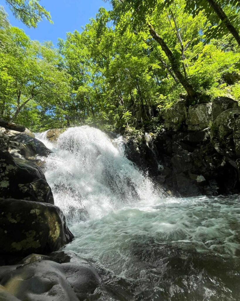
- Cedar Run Falls Out & Back – Cedar Run Falls is my favorite swimming hole in the canyon! It’s only 1.5 miles from the parking area (3 miles round-trip) and deeper than Lower Whiteoak, which allows for an actual swim. However, it is also rockier and steeper. You’ll gain about 750 feet in the 1.5 miles.
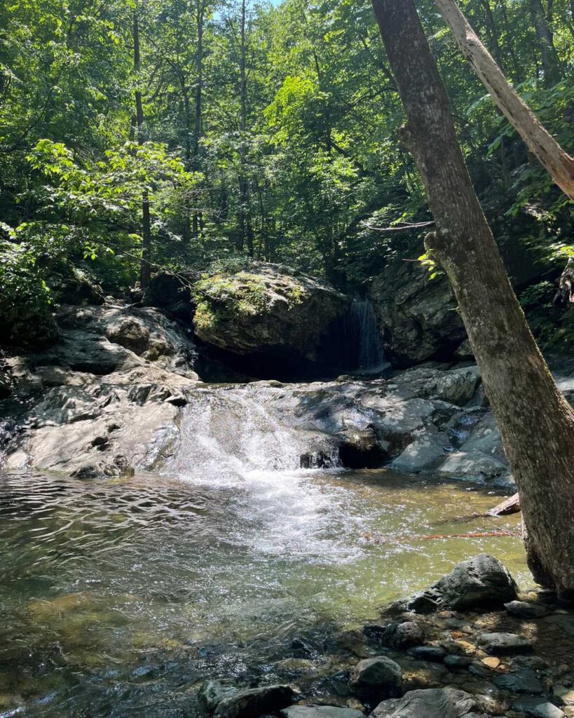
Rose River Loop & Dark Hollow Falls
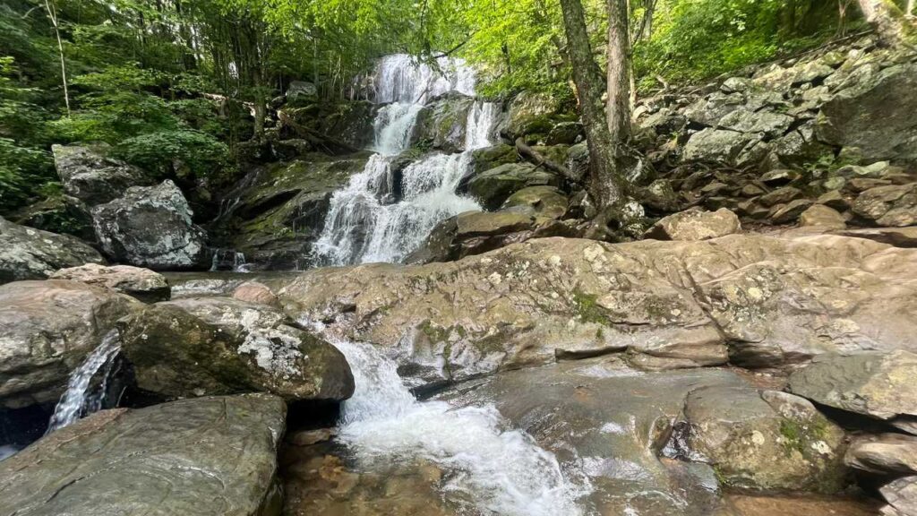
If you can only hike one waterfall loop in Shenandoah National Park, the Rose River and Dark Hollow Falls circuit is a strong contender. In just 7 miles, this hike packs an impressive amount of scenery, featuring two of the park’s most beautiful waterfalls, numerous cascades, and countless opportunities to cool off beside rushing mountain streams.
What makes this hike especially appealing in summer is the variety. Dark Hollow Falls delivers one of Shenandoah’s most iconic waterfalls, while Rose River offers a quieter, more intimate experience with multiple stream crossings, moss-covered rocks, and secluded pools. The constant presence of water keeps temperatures noticeably cooler than many ridge-top trails, making it an ideal choice on hot, humid days. Add in the relatively modest mileage and abundant swimming and wading opportunities, and it’s easy to see why this loop remains one of the park’s most popular summer adventures.
I like to approach this loop from the Fischers Gap Overlook (mile 49.4) and begin with 1.3 miles on the southbound Appalachian Trail. At the Big Meadows campground, head over to the Story of the Forest Trail, which will get you to Skyline Drive and the start of the Dark Hollow Falls trail, allowing you to hike down along the cascades. There are a few spots along the falls that invite you to sit and enjoy the views and even dip your toes.
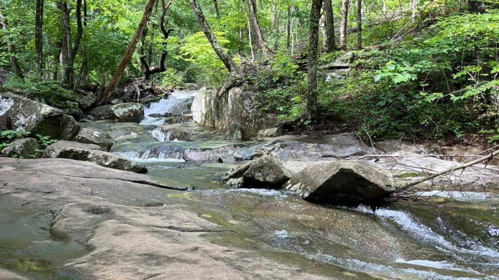
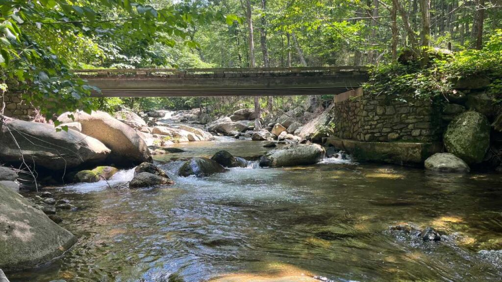
At the bottom of the Dark Hollow Falls trail, enjoy one last look at the falls before continuing on. Then turn right onto the Rose River Fire Road and take a slight left on the Rose River Loop Trail. For about a mile and a half, you will continue on a gradual downhill slope along the rocky trail with the River on your left. There are many natural water slides and shallow pools to enjoy throughout this entire section.
Be sure you’ve taken time to cool off before you cross the bridge because you’ll soon start your ascent, moving away from the water until you reach Rose River Falls. There is a fantastic spot to cool off at the base of the falls, but the descent is steep. If you’d rather enjoy the view from the trail, you can always dip your toes in the shallow stream above the falls before completing the loop with an additional 1.5 miles to your car.
Options: If you look at the area map, you’ll notice several connecting trails, making this a great area to customize your route. Here are a couple more that I enjoy:
- Rose River Loop with Dark Hollow Falls Spur 4.25 miles, 910’ elevation gain. Follow the route in the NPS map below with the added ¼ mile for Dark Hollow Falls.
- Three Waterfall Loop: Lewis Spring Falls, Dark Hollow Falls, and Rose River Falls, 9.3 miles, 2192’ elevation gain. This is similar to the primary loop above, but instead of cutting through the Big Meadows Campground to the Story of the Forest Trail, you continue on the AT to the Lewis Spring Falls Trail.
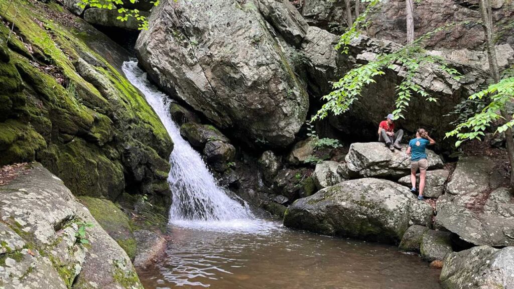
Staunton River Trail to Bear Church Rock – Central District
Bear Church Rock is one of my favorite views of the park’s Wilderness Area. It is especially beautiful at the beginning of June when the Mountain Laurel is still in bloom. However, at 8 miles and 2,000’ of elevation gain, it can be a tough hike. Luckily, if you hike from the boundary, a dip in the Stauton River on your way back to the car will revive you!
From the Graves Mill Parking area, you’ll take the Graves Mill trail for ½ mile, then turn left on the Stauton River Trail. The swimming hole is only a mile from there. I usually start my hike early for the climb to the overlook, so I keep going to the Jones Mountain Trail from there. You’ll have a 1.5-mile steep hike to the overlook, where you can enjoy a snack and the views before heading back and reaping your reward in the form of a refreshing swim.
Option: If you want to skip the incline and just enjoy the swim, consider hiking the .6 miles to the swimming hole, then adding the Graves Mill hike listed below.
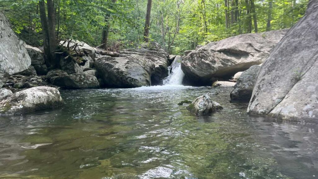
Graves Mill & Rapidan River – Central District
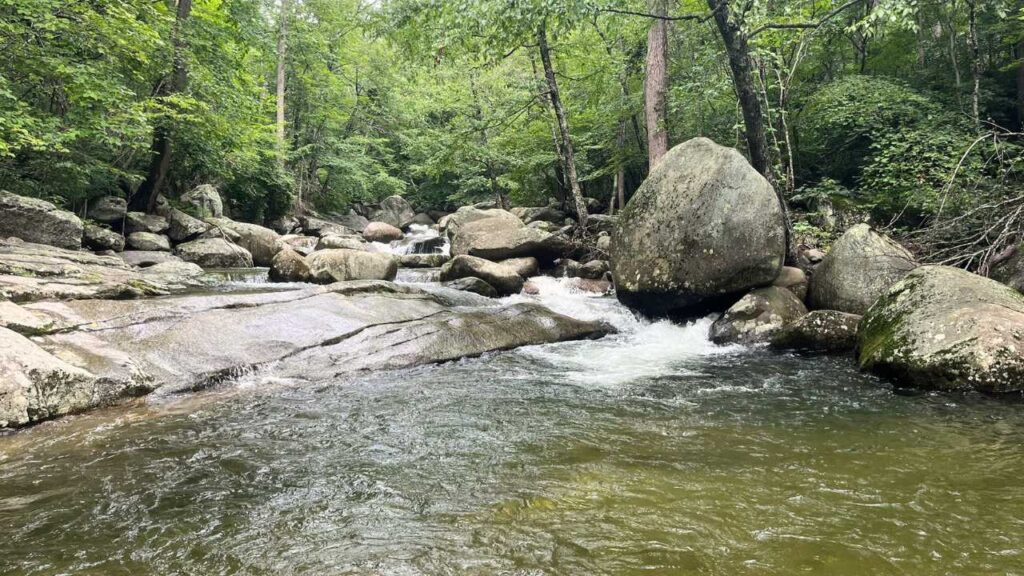
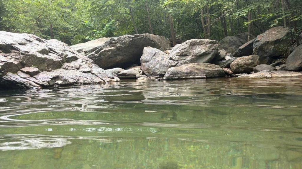
If I had to pick just one swimming hole in Shenandoah, it would be a tough job, but Graves Mill is definitely it! There are several wading spots and a phenomenal natural pool deep enough to swim in. This hike is just 4.7 miles and 486’ elevation gain–basically a walk in the park. From the parking area at the boundary, you’ll reach the swimming hole in two easy miles. There’s also a beautiful view from the bridge over the Rapidan River in another 0.3 miles. I usually go there, then stop at the swimming hole on my way back to the parking area.
Option: If you’d like to get in a workout before your swim, you can either continue left from the bridge up the Rapidan Fire Road for a few miles or choose the long Staunton River & Graves Mill Loop Trail, 13.2 miles, 2126′ elevation gain.
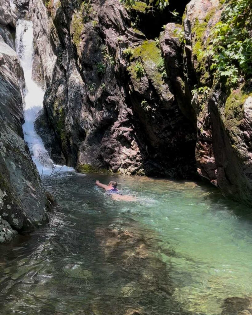
Riprap & Wildcat Ridge Loop – Southern District
This is my favorite swimming hole in the southern district. The spring-fed natural pool is always full of water and never crowded. It is also deep enough for actual swimming. However, be aware that the lack of demand is due to the strenuous nature of this loop. It is 10 miles with over 2200’ of elevation gain. The swimming hole is close to the lowest point, so you’ll have a steep slog back up to your vehicle. I prefer to park at the Wildcat Ridge trailhead and hike counterclockwise. You’ll enjoy 3.5 miles of the Appalachian Trail and knock out some of your elevation before turning onto the Riprap Trail, where you’ll hike an additional 3 miles alongside some cool rock formations and fantastic views on your way to enjoy a refreshing swim in the bracing mountain water. After enjoying the swimming hole, it is about 3.1 miles to the parking lot via the Riprap and Wildcat Ridge trails.
Watch a short video of this hike and swimming hole.
Option: A shorter, slightly less-elevated hike is the 7.5-mile out-and-back via Wildcat Ridge. After your swim, the uphill hike is only about 1700’ to your car.
Moormans River Swimming Holes – Southern District
There are a couple of swimming holes along the Moorman River in the southern district of Shenandoah National Park. The best way to access these swimming holes is from the parking area at the back of the Sugar Hollow Reservoir in Crozet, Virginia. You can choose just one or do both in only 7.5 miles.
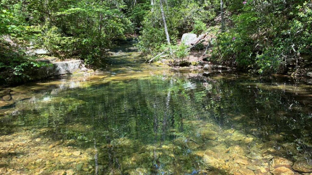
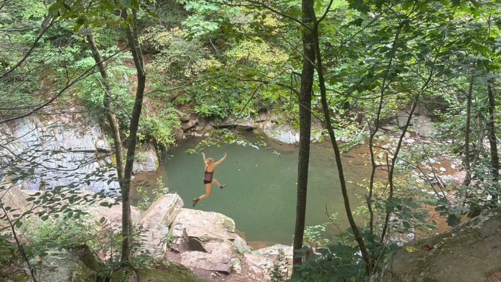
The best of the two is called the Blue Hole locally, but I’m not quite sure why. It’s always been green when I’ve been there. However, it has a great ledge to jump off and has one of the deepest natural pools in the park. The total out-and-back distance for this hike from the Sugar Hollow Reservoir Parking area on the South Fork Moormans River Trail is 3 miles with 400’ of elevation gain.
The second is on the North Fork Moormans River Trail. It is at the second water crossing on the way to Big Branch Falls. Typically, I’ll hike to Big Branch Falls, enjoy the view, and then stop at the aforementioned swimming spot on my way back. The total round-trip distance for this choice from the Sugar Hollow Reservoir Parking area is about 4.5 miles with 500’ elevation gain.
Option: Hike to the Blue Hole from Skyline Drive via the Turk Branch Trail to the South Fork Moormans River Trail for a total out-and-back distance of 5 miles with 1175’ elevation gain. The disadvantage here is that all the elevation is post-swim on your return to the parking area. If I were to do this hike from Skyline, I’d start early and add on the 2.5-mile round-trip Turk Mountain Trail to see the valley views first. Then head down to the swimming hole for a swim and lunch.
I also started a new YouTube Shorts playlist featuring videos of each swimming hole.
Sharing is Caring!
If you enjoyed this post, please feel free to share it with your friends or on social media.

Leave a Reply